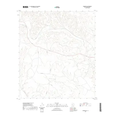
2019 Map of Sanderson SE
USGS Topo · Published 2019About this map
Sanderson Canyon and Seminole Canyon dominate this high-desert reach of Terrell County, where deep drainage networks carve through the limestone plateau. The landscape is defined by its seasonal watercourses, notably Sanderson Cr, which snakes through the primary canyon floor. A sparse network of ranch roads provides the only access to this remote territory, many named for local families and landmarks. Historical land use is suggested by routes such as Bone Water Rd and Gatlin Rd, which navigate the complex topography between the primary canyons and Isinglass Canyon in the southwest corner. The map captures the area in the late 2010s, showing how modern transportation routes like US Route 90 follow the natural contours established by the canyon systems.
Find a feature on this map
11 named features on this map. Tap any name to fly to it.
Don’t see what you’re looking for? This feature index may not catch every label — zoom into the map to look around manually.
Map Details
Editions of this 2019 Sanderson SE Map
This is the sole edition of this map. No revisions or reprints were ever made.
Other maps of this area

1918 · Dryden Crossing
USGS Topo · 1:62,500

1918 · Indian Wells
USGS Topo · 1:62,500

1928 · Sanderson
USGS Topo · 1:125,000

1954 · Fort Stockton
USGS Topo · 1:250,000

1958 · Fort Stockton
USGS Topo · 1:250,000

1959 · Emory Peak
USGS Topo · 1:250,000

1965 · Emory Peak
USGS Topo · 1:250,000

1969 · Sanderson SE
USGS Topo · 1:24,000

1969 · Sanderson
USGS Topo · 1:24,000

1969 · Mofeta
USGS Topo · 1:24,000