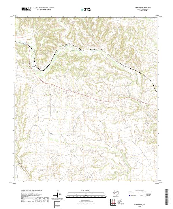
2022 Map of Sanderson SE
USGS Topo · Published 2022About this map
Sanderson Canyon and Seminole Canyon dominate this high-relief terrain in Terrell County, illustrating the intricate drainage patterns of the Trans-Pecos region. The landscape is defined by deep incisions through limestone plateaus, most notably along Sanderson Cr. Unlike more developed areas, the human footprint here is limited to a sparse network of ranch and access roads such as Bone Water Rd and Carruthers Rd, which follow the contours of the high ground between the canyons. The mapping of Isinglass Canyon in the southwest corner highlights the convergence of these dry wash systems. This 2022 data reflects the modern conservation and land management of this arid environment, where water flow is intermittent but has shaped every visible ridge and draw.
Find a feature on this map
11 named features on this map. Tap any name to fly to it.
Don’t see what you’re looking for? This feature index may not catch every label — zoom into the map to look around manually.
Map Details
Editions of this 2022 Sanderson SE Map
This is the sole edition of this map. No revisions or reprints were ever made.
Other maps of this area

1918 · Dryden Crossing
USGS Topo · 1:62,500

1918 · Indian Wells
USGS Topo · 1:62,500

1928 · Sanderson
USGS Topo · 1:125,000

1954 · Fort Stockton
USGS Topo · 1:250,000

1958 · Fort Stockton
USGS Topo · 1:250,000

1959 · Emory Peak
USGS Topo · 1:250,000

1965 · Emory Peak
USGS Topo · 1:250,000

1969 · Sanderson SE
USGS Topo · 1:24,000

1969 · Sanderson
USGS Topo · 1:24,000

1969 · Mofeta
USGS Topo · 1:24,000