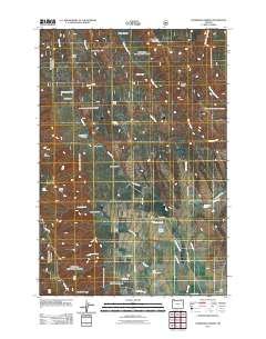
2011 Map of Sanderson Spring
USGS Topo · Published 2011About this map
Finley Creek Cow Camp and isolated dwellings like Stanley Cabin and Craigs Cabin characterize this high-elevation landscape within the Blue Mountains of Umatilla County. The terrain is defined by a dense network of ridges and canyons, including Rocky Ridge, Pfefferkorn Ridge, and Moonshine Canyon, where water sources were critical for seasonal ranching and transit. Small-scale water management is evident through the presence of Jarvis Ponds, Feik Reservoirs, and various named springs like McMillen Spring and the eponymous Sanderson Spring. The road network, consisting of routes like Skyline Rd and Ruckle Rd, follows the natural contours of the land, connecting these remote outposts and ridges. This survey provides a clear view of the geographic naming conventions used by early settlers and ranchers in this part of northeastern Oregon.
Find a feature on this map
44 named features on this map. Tap any name to fly to it.
Don’t see what you’re looking for? This feature index may not catch every label — zoom into the map to look around manually.
Map Details
Editions of this 2011 Sanderson Spring Map
This is the sole edition of this map. No revisions or reprints were ever made.
Other maps of this area

1906 · Telocaset
USGS Topo · 1:125,000

1953 · Pendleton
USGS Topo · 1:250,000

1955 · Grangeville
USGS Topo · 1:250,000

1956 · Pendleton
USGS Topo · 1:250,000

1959 · Grangeville
USGS Topo · 1:250,000

1963 · Andies Prairie
USGS Topo · 1:24,000

1963 · Sanderson Spring
USGS Topo · 1:24,000

1963 · Bingham Springs
USGS Topo · 1:24,000

1963 · Summerville
USGS Topo · 1:24,000

1964 · Partridge Creek
USGS Topo · 1:24,000