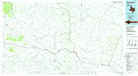
1985 Map of Sanderson
USGS Topo · Published 1985About this map
Sanderson serves as the focal point of this Trans-Pecos landscape, situated at a critical juncture where the Southern Pacific railroad parallels the course of Sanderson Creek. The 1985 planimetric data reveals a territory defined by complex drainage systems and isolated peaks, such as Castle Mountain and Sugar Loaf Mountain. Small outposts like Dryden and Tesnus mark the rail line as it moves through the expansive Downie Draw and Big Canyon. The presence of the County Airport and various radio towers reflects the modernization of this arid ranching country. Genealogists and historians can trace the intricate network of canyons—including Meyers Canyon and Seminole Canyon—that have historically dictated the movement of livestock and people through Terrell Co and its neighboring districts.
Find a feature on this map
72 named features on this map. Tap any name to fly to it.
Don’t see what you’re looking for? This feature index may not catch every label — zoom into the map to look around manually.
Map Details
Editions of this 1985 Sanderson Map
2 editions found
Other maps of this area

1917 · Hood Spring
USGS Topo · 1:62,500

1918 · Bone Spring
USGS Topo · 1:125,000

1918 · Hood Spring
USGS Topo · 1:62,500

1918 · Dryden Crossing
USGS Topo · 1:62,500

1918 · Dove Mountain
USGS Topo · 1:62,500

1918 · Bullis Gap
USGS Topo · 1:62,500

1918 · Indian Wells
USGS Topo · 1:62,500

1920 · Longfellow
USGS Topo · 1:125,000

1920 · Marathon
USGS Topo · 1:62,500

1921 · Marathon
USGS Topo · 1:62,500