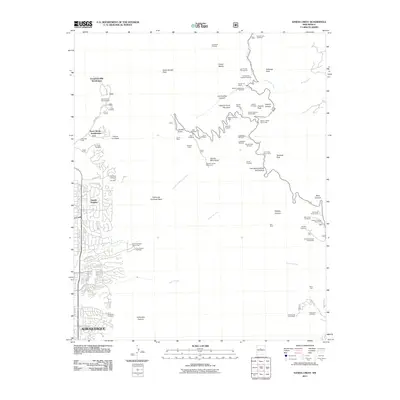
2011 Map of Sandia Crest
USGS Topo · Published 2011About this map
Albuquerque expansion meets the steep eastern rise of the Sandia Mountains in this early 21st-century record. The map details a landscape where residential developments like Sandia Heights and Evergreen Hills Subdivision terminate abruptly at the forest boundary. Beyond the suburban edge, the terrain is defined by extreme verticality, punctuated by historic resource extraction sites including La Luz Mine, Las Huertas Copper Prospects, and the Schmidt Prospect. High-altitude recreation is well established here, centering on the Sandia Peak Ski Area and the Summit House Restaurant at the Sandia Crest. Further east, the small settlement of Canoncito and the Canoncito Cemetery represent the more rural, quiet character of the canyons, away from the bustling city and the tourist traffic of the Tramway.
Find a feature on this map
79 named features on this map. Tap any name to fly to it.
Don’t see what you’re looking for? This feature index may not catch every label — zoom into the map to look around manually.
Map Details
Editions of this 2011 Sandia Crest Map
This is the sole edition of this map. No revisions or reprints were ever made.
Other maps of this area

1888 · Bernalillo
USGS Topo · 1:125,000

1889 · Albuquerque
USGS Topo · 1:125,000

1892 · San Pedro
USGS Topo · 1:125,000

1893 · Albuquerque
USGS Topo · 1:125,000

1934 · Alameda
USGS Topo · 1:24,000

1934 · East Albuquerque
USGS Topo · 1:24,000

1938 · Albuquerque
USGS Topo · 1:62,500

1954 · Sandia Crest
USGS Topo · 1:24,000

1954 · Alameda
USGS Topo · 1:24,000

1954 · Placitas
USGS Topo · 1:24,000
Featured Places
- Albuquerque, NM
- Cedar Crest, NM
- Evergreen Hills Subdivision, NM
- Tierra Monte Subdivision, NM
- Sandia Heights, Albuquerque