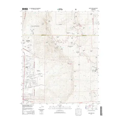
2013 Map of Sandia Crest
USGS Topo · Published 2013About this map
The Sandia Mountains dominate this 2013 landscape, where the high-altitude terrain of the Cibola National Forest meets the expanding residential fringes of Albuquerque. Rising to the prominent Sandia Crest and North Sandia Peak, the area serves as a significant recreational hub, featuring the Sandia Peak Ski Area, the Tree Spring Winter Sports Area, and a dense network of trails such as the La Luz Trailhead and Crest Trailhead.
Find a feature on this map
113 named features on this map. Tap any name to fly to it.
Don’t see what you’re looking for? This feature index may not catch every label — zoom into the map to look around manually.
Map Details
Editions of this 2013 Sandia Crest Map
This is the sole edition of this map. No revisions or reprints were ever made.
Other maps of this area

1888 · Bernalillo
USGS Topo · 1:125,000

1889 · Albuquerque
USGS Topo · 1:125,000

1892 · San Pedro
USGS Topo · 1:125,000

1893 · Albuquerque
USGS Topo · 1:125,000

1934 · Alameda
USGS Topo · 1:24,000

1934 · East Albuquerque
USGS Topo · 1:24,000

1938 · Albuquerque
USGS Topo · 1:62,500

1954 · Sandia Crest
USGS Topo · 1:24,000

1954 · Alameda
USGS Topo · 1:24,000

1954 · Placitas
USGS Topo · 1:24,000
Featured Places
- Albuquerque, NM
- Cedar Crest, NM
- Evergreen Hills Subdivision, NM
- Tierra Monte Subdivision, NM
- Sandia Heights, Albuquerque