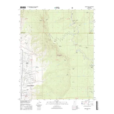
2017 Map of Sandia Crest
USGS Topo · Published 2017About this map
Sandia Crest dominates the eastern horizon of Albuquerque, marking a dramatic rise from the residential edge of Sandia Heights into the protected wilderness of the Cibola National Forest. This 2017 survey shows the juxtaposition of suburban expansion and the precipitous terrain of the Sandia Mountains. The map traces a dense network of mountain springs and canyons, including Osha Spring and Bear Canyon, which have historically provided vital water in this arid climate. On the eastern slopes, the settlement of Sandia Park and the rural community of Cañoncito provide a glimpse into the area's development outside the city proper. Genealogists and local historians will find the Canoncito Cem and the winding route of the Sandia Crest Scenic Hwy particularly useful for orienting family landmarks against the backdrop of N Sandia Peak and Kiwanis Meadow.
Find a feature on this map
103 named features on this map. Tap any name to fly to it.
Don’t see what you’re looking for? This feature index may not catch every label — zoom into the map to look around manually.
Map Details
Editions of this 2017 Sandia Crest Map
This is the sole edition of this map. No revisions or reprints were ever made.
Other maps of this area

1888 · Bernalillo
USGS Topo · 1:125,000

1889 · Albuquerque
USGS Topo · 1:125,000

1892 · San Pedro
USGS Topo · 1:125,000

1893 · Albuquerque
USGS Topo · 1:125,000

1934 · Alameda
USGS Topo · 1:24,000

1934 · East Albuquerque
USGS Topo · 1:24,000

1938 · Albuquerque
USGS Topo · 1:62,500

1954 · Sandia Crest
USGS Topo · 1:24,000

1954 · Alameda
USGS Topo · 1:24,000

1954 · Placitas
USGS Topo · 1:24,000
Featured Places
- Albuquerque, NM
- Cedar Crest, NM
- Evergreen Hills Subdivision, NM
- Tierra Monte Subdivision, NM
- Sandia Heights, Albuquerque