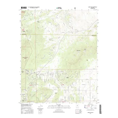
2017 Map of Sandia Park
USGS Topo · Published 2017About this map
San Antonito and Cedar Crest anchor this 2017 survey of the eastern slopes of the Sandia Mountains, where high-desert terrain meets established residential pockets. The map documents the residential expansion within Sandia Knolls and along the winding roads of Gutierrez Canyon, contrasting the developed foothills with the protected expanse of the Cibola National Forest. For genealogists and local historians, the La Madera Cem and the settlement of La Madera provide specific points of interest in the northern portion of the sheet. The landscape is defined by a complex network of arroyos and canyons, including Tejano Canyon and Cienega Canyon, which channel seasonal runoff toward San Pedro Creek. Remnants of earlier transportation routes are visible in labels like Stagecoach Rd and Old Rail Pass, suggesting the historical movement through these mountain passes before modern development.
Find a feature on this map
174 named features on this map. Tap any name to fly to it.
Don’t see what you’re looking for? This feature index may not catch every label — zoom into the map to look around manually.
Map Details
Editions of this 2017 Sandia Park Map
This is the sole edition of this map. No revisions or reprints were ever made.
Other maps of this area

1892 · San Pedro
USGS Topo · 1:125,000

1954 · Sandia Crest
USGS Topo · 1:24,000

1954 · Placitas
USGS Topo · 1:24,000

1954 · Sandia Park
USGS Topo · 1:24,000

1954 · San Pedro
USGS Topo · 1:24,000
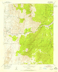
1954 · Tijeras
USGS Topo · 1:24,000

1954 · Sedillo
USGS Topo · 1:24,000

1954 · Hagan
USGS Topo · 1:24,000

1954 · Edgewood
USGS Topo · 1:24,000

1954 · San Felipe Pueblo
USGS Topo · 1:62,500