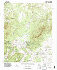
1990 Map of Sandia Park
USGS Topo · Published 1996About this map
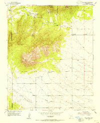
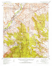
The San Pedro Mountains dominate the central landscape of this New Mexico quadrangle, where the cultural history of the East Mountains is visible through diverse landmarks. Local heritage is anchored by the Pa-ako Ruins and the La Madera Cemetery, while modern development shows in the clustering of residential pockets like Sandia Knolls and San Antonito. This area serves as a transit corridor, where the remnants of an Old Railroad Grade and an Old Stagecoach Road intersect with more modern infrastructure like the northern Pipeline.
Find a feature on this map
33 named features on this map. Tap any name to fly to it.
Don’t see what you’re looking for? This feature index may not catch every label — zoom into the map to look around manually.
Map Details
Editions of this 1990 Sandia Park Map
This is the sole edition of this map. No revisions or reprints were ever made.
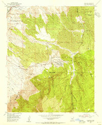
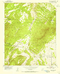
Other maps of this area

1892 · San Pedro
USGS Topo · 1:125,000
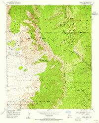
1954 · Sandia Crest
USGS Topo · 1:24,000
1954 · Placitas
USGS Topo · 1:24,000
1954 · Sandia Park
USGS Topo · 1:24,000
1954 · San Pedro
USGS Topo · 1:24,000

1954 · Tijeras
USGS Topo · 1:24,000
1954 · Sedillo
USGS Topo · 1:24,000
1954 · Hagan
USGS Topo · 1:24,000
1954 · Edgewood
USGS Topo · 1:24,000
1954 · San Felipe Pueblo
USGS Topo · 1:62,500