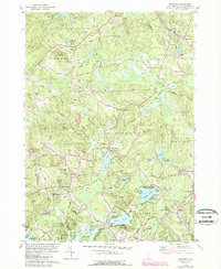
1981 Map of Sandown
USGS Topo · Published 1989About this map
The Exeter River and numerous glacial ponds define the geography of Rockingham County in this late-century topographic study. Settlement is concentrated around traditional village centers like Sandown and Fremont, while the southern reaches show the expansion of West Hampstead and East Hampstead. For genealogists and local researchers, the map is particularly rich in family-named landmarks and resting places, including Sanborn Cem, Wells Cem, and the Hadley Cem near the southern border.
Find a feature on this map
80 named features on this map. Tap any name to fly to it.
Don’t see what you’re looking for? This feature index may not catch every label — zoom into the map to look around manually.
Map Details
Editions of this 1981 Sandown Map
3 editions found
Other maps of this area

1888 · Haverhill
USGS Topo · 1:62,500

1890 · Haverhill
USGS Topo · 1:62,500

1893 · Haverhill
USGS Topo · 1:62,500

1905 · Manchester
USGS Topo · 1:62,500

1917 · Mt. Pawtuckaway
USGS Topo · 1:62,500

1919 · Mt. Pawtuckaway
USGS Topo · 1:62,500

1921 · Suncook
USGS Topo · 1:62,500

1935 · Haverhill
USGS Topo · 1:62,500

1939 · Mt. Pawtuckaway
USGS Topo · 1:62,500

1941 · Manchester
USGS Topo · 1:62,500