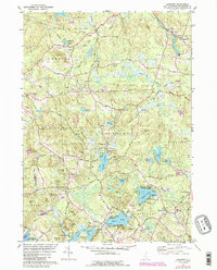
1981 Map of Sandown
USGS Topo · Published 1989About this map
Phillips Pond and the surrounding woodlands of Rockingham County characterize this survey of southeastern New Hampshire. The landscape is defined by its glacial heritage, with numerous kettle ponds such as Wash Pond, Angle Pond, and Island Pond dotting the terrain between prominent elevations like Smith Mtn and Walnut Hill. The settlement patterns of Sandown, Fremont, and West Hampstead show a reliance on historic transport corridors, notably the Boston and Maine Railroad which cuts through the region.
Find a feature on this map
77 named features on this map. Tap any name to fly to it.
Don’t see what you’re looking for? This feature index may not catch every label — zoom into the map to look around manually.
Map Details
Editions of this 1981 Sandown Map
3 editions found
Other maps of this area

1888 · Haverhill
USGS Topo · 1:62,500

1890 · Haverhill
USGS Topo · 1:62,500

1893 · Haverhill
USGS Topo · 1:62,500

1905 · Manchester
USGS Topo · 1:62,500

1917 · Mt. Pawtuckaway
USGS Topo · 1:62,500

1919 · Mt. Pawtuckaway
USGS Topo · 1:62,500

1921 · Suncook
USGS Topo · 1:62,500

1935 · Haverhill
USGS Topo · 1:62,500

1939 · Mt. Pawtuckaway
USGS Topo · 1:62,500

1941 · Manchester
USGS Topo · 1:62,500