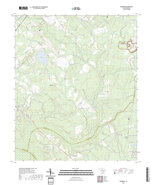
2024 Map of Sandridge
USGS Topo · Published 2024About this map
Sandridge and Tugtown anchor this 2024 landscape in the South Carolina Lowcountry, where the tri-county boundaries of Orangeburg, Berkeley, and Dorchester meet. The terrain is characterized by a complex network of wetlands and ephemeral water bodies including Toney Bay, Cedar Swamp, and the northern reaches of Four Hole Swamp. These features, along with Moon Savanna and Vandore Bay, illustrate the distinct hydrological patterns that have shaped local land use and settlement since the colonial era.
Find a feature on this map
92 named features on this map. Tap any name to fly to it.
Don’t see what you’re looking for? This feature index may not catch every label — zoom into the map to look around manually.
Map Details
Editions of this 2024 Sandridge Map
This is the sole edition of this map. No revisions or reprints were ever made.
Other maps of this area

1919 · Summerville
USGS Topo · 1:48,000

1919 · Ridgeville
USGS Topo · 1:48,000

1920 · Eutawville
USGS Topo · 1:48,000

1920 · Chicora
USGS Topo · 1:48,000

1920 · Ridgeville
USGS Topo · 1:62,500

1920 · Summerville
USGS Topo · 1:62,500

1921 · Chicora
USGS Topo · 1:62,500

1921 · Eutawville
USGS Topo · 1:62,500

1943 · Chicora
USGS Topo · 1:62,500

1943 · Ridgeville
USGS Topo · 1:62,500