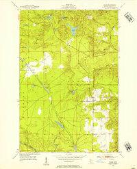
1952 Map of Sands
USGS Topo · Published 1954About this map
The Chicago and North Western railroad forms the central corridor of this 1952 study, connecting the small settlements of Sands and Sands Station with the mining and logging outposts of the Upper Peninsula. The landscape is defined by the high elevations of the Kona Hills and a dense network of water bodies, including Pelesier Lake and Powell Lake. To the northwest, the community of Cascade and nearby Gravel Pits indicate the industrial activities of the era, while the eastern portion of the map is crossed by numerous streams such as Cedar Creek and Silver Creek. The Branch Escanaba River cuts through the southwest corner, highlighting the drainage patterns that shaped early development in Marquette County. Local historians will find the specific locations of rural clusters like Gentian and Peterson essential for tracing family ties in this transition zone of the Michigan forest.
Find a feature on this map
32 named features on this map. Tap any name to fly to it.
Don’t see what you’re looking for? This feature index may not catch every label — zoom into the map to look around manually.
Map Details
Editions of this 1952 Sands Map
4 editions found
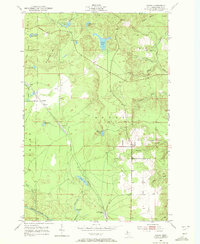
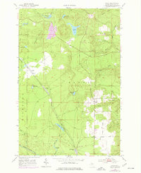
Other maps of this area

1907 · Marquette
USGS Topo · 1:62,500

1932 · Harvey NW
USGS Topo · 1:31,680

1932 · Harvey SE
USGS Topo · 1:31,680

1932 · Harvey SW
USGS Topo · 1:31,680

1932 · Harvey NE
USGS Topo · 1:31,680

1952 · Sands
USGS Topo · 1:24,000

1952 · Ishpeming
USGS Topo · 1:62,500

1952 · Gwinn
USGS Topo · 1:62,500

1952 · Palmer
USGS Topo · 1:24,000

1952 · Gwinn
USGS Topo · 1:24,000