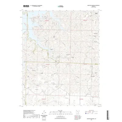
2020 Map of Sandstone Mountain
USGS Topo · Published 2020About this map
Beaver Lake defines the northwestern corner of this landscape, its fingers reaching into the deeply dissected hills of Carroll and Madison counties. The terrain is characterized by a dense network of hollows and ridges, many bearing names that hint at early industry and settlement, such as Durham Mill Hollow, Turpentine Hollow, and Hogscald Hollow. To the east, the rural communities of Lone Star and West Liberty are joined by high points like Grindstone Mtn and Pond Mtn.
Find a feature on this map
135 named features on this map. Tap any name to fly to it.
Don’t see what you’re looking for? This feature index may not catch every label — zoom into the map to look around manually.
Map Details
Editions of this 2020 Sandstone Mountain Map
This is the sole edition of this map. No revisions or reprints were ever made.
Other maps of this area

1900 · Eureka Springs
USGS Topo · 1:125,000

1901 · Eureka Springs
USGS Topo · 1:125,000

1945 · Harrison
USGS Topo · 1:250,000

1949 · Harrison
USGS Topo · 1:250,000

1954 · Harrison
USGS Topo · 1:250,000

1957 · Mundell
USGS Topo · 1:24,000

1957 · War Eagle
USGS Topo · 1:24,000
1957 · Beaver
USGS Topo · 1:24,000
1958 · Spring Valley
USGS Topo · 1:24,000

1958 · Hindsville
USGS Topo · 1:24,000