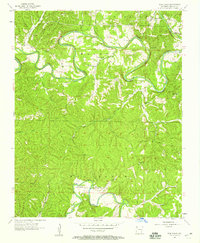
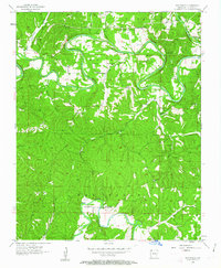
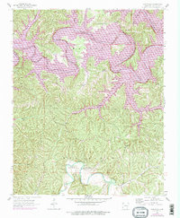
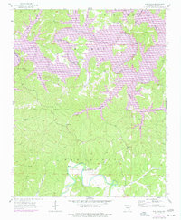
1957 Map of War Eagle
USGS Topo · Published 1959About this map
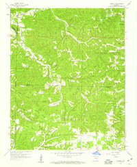
War Eagle Creek and the White River carve a winding course through this section of the Ozarks, defining a landscape of deep hollows and high bluffs before the regional river systems were altered by large-scale damming. The small community of War Eagle serves as a local focal point near the river's bend, while the settlement of Larue sits further north. The map reveals a dispersed rural society anchored by country institutions such as Coal Gap Sch, Rocky Branch Sch, and Bland Chapel.
Find a feature on this map
40 named features on this map. Tap any name to fly to it.
Don’t see what you’re looking for? This feature index may not catch every label — zoom into the map to look around manually.
Map Details
Editions of this 1957 War Eagle Map
4 editions found
Other maps of this area

1899 · Fayetteville
USGS Topo · 1:125,000

1900 · Eureka Springs
USGS Topo · 1:125,000

1901 · Eureka Springs
USGS Topo · 1:125,000

1901 · Fayetteville
USGS Topo · 1:125,000

1904 · Fayetteville
USGS Topo · 1:125,000

1945 · Harrison
USGS Topo · 1:250,000

1949 · Harrison
USGS Topo · 1:250,000

1954 · Harrison
USGS Topo · 1:250,000

1954 · Tulsa
USGS Topo · 1:250,000
1957 · Mundell
USGS Topo · 1:24,000