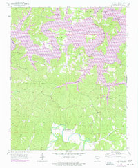
1957 Map of War Eagle
USGS Topo · Published 1977About this map
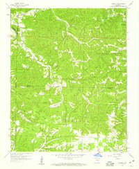
The War Eagle Creek corridor in Benton County defined the local landscape during this mid-century period, centered on the historic settlement of War Eagle. This survey reveals the transition of the northern terrain as the White River was impounded to form Beaver Lake, a transformation noted in purple revision layers. The area is a mosaic of small-scale agriculture and community hubs, evidenced by institutions like Coal Gap Sch and Bland Chapel. Moving away from the new shoreline, the map identifies local landmarks such as Copper Mine and Sheep Cave, alongside family burial sites including Webb Cem and Martin Cem. The small settlements of Larue and Glade anchor the upland ridges, reflecting a rural Ozark way of life just as modern recreation areas like the Rocky Branch Public Use Area began to emerge.
Find a feature on this map
43 named features on this map. Tap any name to fly to it.
Don’t see what you’re looking for? This feature index may not catch every label — zoom into the map to look around manually.
Map Details
Editions of this 1957 War Eagle Map
4 editions found
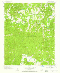
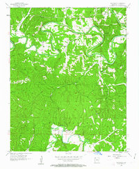
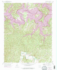
Other maps of this area

1899 · Fayetteville
USGS Topo · 1:125,000

1900 · Eureka Springs
USGS Topo · 1:125,000

1901 · Eureka Springs
USGS Topo · 1:125,000

1901 · Fayetteville
USGS Topo · 1:125,000

1904 · Fayetteville
USGS Topo · 1:125,000

1945 · Harrison
USGS Topo · 1:250,000

1949 · Harrison
USGS Topo · 1:250,000

1954 · Harrison
USGS Topo · 1:250,000

1954 · Tulsa
USGS Topo · 1:250,000
1957 · Mundell
USGS Topo · 1:24,000