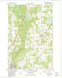
1981 Map of Sandstone North
USGS Topo · Published 1982About this map
The Kettle River carves a central path through this portion of Pine County, defining a landscape shaped by both glacial hydrology and industrial extraction. In the early 1980s, the area around Sandstone and Askov reveals a transition from rail-dependent industry to conservation and recreation. The Burlington Northern line runs parallel to the river, while an Old RR Grade south of Banning State Park indicates earlier transportation routes that once served local commerce. Geologic features such as Wolf Creek Falls, Hell's Gate, and the Big Sink Hole punctuate the terrain, highlighting the dramatic river valley topography. Human activity is evidenced by numerous Gravel Pits and a Quarry near the Sandstone townsite, while small settlements like Ames and Lundgren mark the rural landscape outside the larger township centers of Finlayson and Partridge.
Find a feature on this map
41 named features on this map. Tap any name to fly to it.
Don’t see what you’re looking for? This feature index may not catch every label — zoom into the map to look around manually.
Map Details
Editions of this 1981 Sandstone North Map
This is the sole edition of this map. No revisions or reprints were ever made.
Other maps of this area

1953 · Duluth
USGS Topo · 1:250,000

1958 · Duluth
USGS Topo · 1:250,000

1961 · Sandstone
USGS Topo · 1:62,500

1961 · Moose Lake
USGS Topo · 1:62,500

1962 · Bruno
USGS Topo · 1:62,500

1962 · Cloverdale
USGS Topo · 1:62,500

1980 · Sandstone
USGS Topo · 1:100,000
1981 · Cloverdale
USGS Topo · 1:24,000
1981 · Askov Lookout Tower
USGS Topo · 1:24,000

1981 · Willow River
USGS Topo · 1:24,000