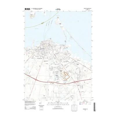
2013 Map of Sandusky
USGS Topo · Published 2013About this map
Sandusky anchors this coastal Erie County landscape, where the urban grid meets the recreational and maritime stretches of Sandusky Bay and Lake Erie. The 2013 geography highlights the prominent Cedar Point peninsula, connected to the mainland via the Cedar Point Causeway and the Moseley Channel. A high concentration of historic cemeteries, including Cholera Cem, Saint Marys Cem, and the Jewish Cem, provides significant points of interest for genealogists tracing the city's diverse heritage. To the south, the landscape transitions from established neighborhoods like MacArthur Park and Lincolnshire toward federal installations and agricultural remnants. The presence of the NASA Plum Brook station and the Ohio Soldiers and Sailors Home Cem reflects the area's long-standing institutional importance, while drainage features like Plum Brook and Liles Ditch illustrate the managed hydrology of the Lake Erie shoreline.
Find a feature on this map
69 named features on this map. Tap any name to fly to it.
Don’t see what you’re looking for? This feature index may not catch every label — zoom into the map to look around manually.
Map Details
Editions of this 2013 Sandusky Map
This is the sole edition of this map. No revisions or reprints were ever made.
Other maps of this area

1901 · Put-In-Bay
USGS Topo · 1:62,500

1901 · Bellevue
USGS Topo · 1:62,500

1903 · Bellevue
USGS Topo · 1:62,500

1903 · Put In Bay
USGS Topo · 1:62,500

1904 · Sandusky
USGS Topo · 1:62,500

1916 · Kelleys Island
USGS Topo · 1:62,500

1919 · Kelleys Island
USGS Topo · 1:62,500

1956 · Toledo
USGS Topo · 1:250,000

1959 · Kimball
USGS Topo · 1:24,000

1959 · Milan
USGS Topo · 1:24,000