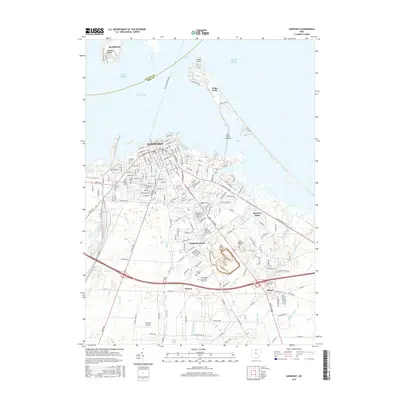
2016 Map of Sandusky
USGS Topo · Published 2016About this map
Sandusky and its waterfront dominate this Erie County landscape, where the urban grid meets the waters of Sandusky Bay and Lake Erie. The map details a complex network of coastal features, from the iconic peninsula of Cedar Point to the historic Johnson Island and Marblehead across the Moseley Channel. A high density of specialized cemeteries, such as the Cholera Cem and the Ohio Soldiers and Sailors Home Cem, offers significant data for genealogists and local historians tracking the community's nineteenth and twentieth-century growth. Moving inland, the map transitions into the residential and light industrial areas of Sandusky South and Fairview Lanes. The presence of Galloway Airport and various drainage features like Hemming Ditch and Plum Brook illustrate the managed hydrology required for the region's development along the lake shore.
Find a feature on this map
143 named features on this map. Tap any name to fly to it.
Don’t see what you’re looking for? This feature index may not catch every label — zoom into the map to look around manually.
Map Details
Editions of this 2016 Sandusky Map
This is the sole edition of this map. No revisions or reprints were ever made.
Other maps of this area

1901 · Put-In-Bay
USGS Topo · 1:62,500

1901 · Bellevue
USGS Topo · 1:62,500

1903 · Bellevue
USGS Topo · 1:62,500

1903 · Put In Bay
USGS Topo · 1:62,500

1904 · Sandusky
USGS Topo · 1:62,500

1916 · Kelleys Island
USGS Topo · 1:62,500

1919 · Kelleys Island
USGS Topo · 1:62,500

1956 · Toledo
USGS Topo · 1:250,000

1959 · Kimball
USGS Topo · 1:24,000

1959 · Milan
USGS Topo · 1:24,000