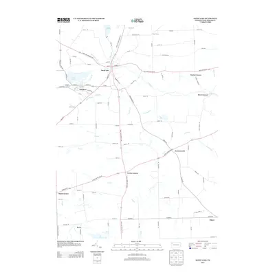
2013 Map of Sandy Lake
USGS Topo · Published 2013About this map
Sandy Lake and Stoneboro serve as the primary hubs in this corner of Mercer County, situated along the drainage of Sandy Creek and the shores of their namesake water bodies. The geography is defined by a network of rural crossroads such as Perrine Corners, Nesbit Corners, and Booher Corners, reflecting a late-twentieth-century pattern of small, dispersed agricultural communities. Water management and recreation are central to the landscape, visible in the sprawling Lake Wilhelm to the north and the Pa-474 Reservoir near the local Fairgrounds. The presence of Reeds Furnace points to the region's industrial past, while the Wesleyan Campground and various named schools like Glenn School indicate long-standing social and community foundations. This map provides a detailed view of the winding creek systems, including Wolf Creek and Butchery Creek, as they move through the undulating terrain south of the Sandy Lake Greenville Road.
Find a feature on this map
97 named features on this map. Tap any name to fly to it.
Don’t see what you’re looking for? This feature index may not catch every label — zoom into the map to look around manually.
Map Details
Editions of this 2013 Sandy Lake Map
This is the sole edition of this map. No revisions or reprints were ever made.
Other maps of this area

1909 · Franklin
USGS Topo · 1:62,500

1910 · Hilliards
USGS Topo · 1:62,500

1911 · Franklin
USGS Topo · 1:62,500

1911 · Stoneboro
USGS Topo · 1:62,500

1912 · Hilliards
USGS Topo · 1:62,500

1913 · Stoneboro
USGS Topo · 1:62,500

1913 · Mercer
USGS Topo · 1:62,500

1939 · Mercer
USGS Topo · 1:62,500

1943 · Mercer
USGS Topo · 1:62,500

1943 · Stoneboro
USGS Topo · 1:62,500
Featured Places
- Sandy Lake, PA
- New Vernon Township, PA
- Jackson Township, PA
- Frenchcreek Township, PA
- Mineral Township, PA