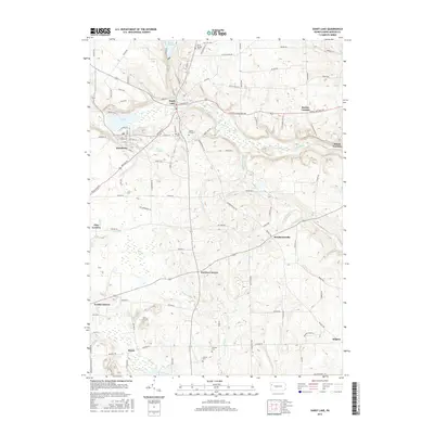
2016 Map of Sandy Lake
USGS Topo · Published 2016About this map
Sandy Lake and Stoneboro serve as the primary hubs of this Pennsylvania landscape, where the waters of Sandy Creek and McCutcheon Run shape the local geography. The map reveals a dense network of rural infrastructure, including historical cemeteries such as Rocky Springs Cem and Oak Hill Cem that provide vital links for genealogical research. To the north, the expanse of Lake Wilhelm dominates the terrain, while the southern reaches transition into more agricultural and wooded areas near Perrine Corners and Hendersonville. A distinct industrial legacy is noted by the presence of Reeds Furnace in the east, indicating the importance of early ironworking in the region. The map also identifies ecological features like Pine Swamp, illustrating the varied wetlands that break up the rolling hills of Mercer County.
Find a feature on this map
107 named features on this map. Tap any name to fly to it.
Don’t see what you’re looking for? This feature index may not catch every label — zoom into the map to look around manually.
Map Details
Editions of this 2016 Sandy Lake Map
This is the sole edition of this map. No revisions or reprints were ever made.
Other maps of this area

1909 · Franklin
USGS Topo · 1:62,500

1910 · Hilliards
USGS Topo · 1:62,500

1911 · Franklin
USGS Topo · 1:62,500

1911 · Stoneboro
USGS Topo · 1:62,500

1912 · Hilliards
USGS Topo · 1:62,500

1913 · Stoneboro
USGS Topo · 1:62,500

1913 · Mercer
USGS Topo · 1:62,500

1939 · Mercer
USGS Topo · 1:62,500

1943 · Mercer
USGS Topo · 1:62,500

1943 · Stoneboro
USGS Topo · 1:62,500
Featured Places
- Sandy Lake, PA
- New Vernon Township, PA
- Jackson Township, PA
- Frenchcreek Township, PA
- Mineral Township, PA