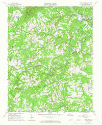
1965 Map of Sandy Level
USGS Topo · Published 1966About this map
The Pigg River carves a winding path through the borderlands of Franklin and Pittsylvania counties, anchoring a rural landscape defined by creek valleys and small farming communities. This mid-1960s survey captures the region just as Leesville Lake and Smith Mountain Lake were reshaping the local hydrology, with the "normal pool elevation" noted at The Fryingpan. Scattered throughout the interior are long-established settlements such as Sandy Level, Ajax, and Museville, linked by narrow roads that cross the river at Canada Bridge and Kirby Ford Bridge.
Find a feature on this map
41 named features on this map. Tap any name to fly to it.
Don’t see what you’re looking for? This feature index may not catch every label — zoom into the map to look around manually.
Map Details
Editions of this 1965 Sandy Level Map
Other maps of this area

1890 · Roanoke
USGS Topo · 1:125,000

1891 · Roanoke
USGS Topo · 1:125,000

1892 · Lynchburg
USGS Topo · 1:125,000

1921 · Chatham
USGS Topo · 1:48,000

1922 · Callands
USGS Topo · 1:48,000

1923 · Chatham
USGS Topo · 1:62,500

1924 · Callands
USGS Topo · 1:62,500

1944 · Callands
USGS Topo · 1:62,500

1947 · Roanoke
USGS Topo · 1:250,000

1951 · Moneta
USGS Topo · 1:62,500