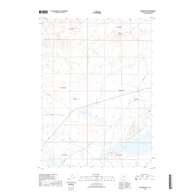
2018 Map of Sanford Ranch
USGS Topo · Published 2018About this map
Sanford Ranch sits within a landscape defined by the intersection of high desert hydrology and historic Western transit corridors. The southern portion of the map is dominated by the seasonal variations of the Pathfinder Reservoir and the Sweetwater River, a vital water source for the region's ranching operations. The terrain is marked by distinctive geological formations such as Black Rock Mtn and Steamboat Rock, providing landmarks that have likely guided travelers for generations. Modern county infrastructure like Buelah Belle Rd and Dry Creek Rd parallels older paths, most notably Emigrant Trail Rd, reflecting the enduring importance of this passage through Natrona County. Small water features like Steamboat Lake and Playa Lake dot the basins, highlighting the delicate balance of water in this arid environment.
Find a feature on this map
21 named features on this map. Tap any name to fly to it.
Don’t see what you’re looking for? This feature index may not catch every label — zoom into the map to look around manually.
Map Details
Editions of this 2018 Sanford Ranch Map
This is the sole edition of this map. No revisions or reprints were ever made.
Other maps of this area

1951 · Benton Basin SW
USGS Topo · 1:24,000

1951 · Pathfinder Reservoir NW
USGS Topo · 1:24,000

1951 · Independence Rock
USGS Topo · 1:24,000

1951 · Mc Cleary Reservoir
USGS Topo · 1:24,000

1951 · Fort Ridge
USGS Topo · 1:24,000

1955 · Casper
USGS Topo · 1:250,000

1958 · Casper
USGS Topo · 1:250,000

1959 · Horse Creek Springs
USGS Topo · 1:24,000

1959 · Sanford Ranch
USGS Topo · 1:24,000

1959 · Saddle Rock
USGS Topo · 1:24,000