
1951 Map of Independence Rock
USGS Topo · Published 1953About this map
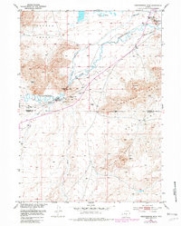
Independence Rock stands as the singular focal point along the Sweetwater River, marking a critical waypoint for 19th-century travelers. This 1951 survey documents the high-desert terrain of the Oregon Trail as it passes through the Devils Gate canyon. The map highlights the intersection of pioneering history and mid-century ranching life, noting the Historical Site where travelers carved their names into the granite.
Find a feature on this map
23 named features on this map. Tap any name to fly to it.
Don’t see what you’re looking for? This feature index may not catch every label — zoom into the map to look around manually.
Map Details
Editions of this 1951 Independence Rock Map
2 editions found
Other maps of this area

1951 · Savage Peak
USGS Topo · 1:24,000

1951 · Fort Ridge
USGS Topo · 1:24,000

1953 · Buzzard Ranch
USGS Topo · 1:24,000

1953 · Spanish Mine
USGS Topo · 1:24,000

1955 · Casper
USGS Topo · 1:250,000

1958 · Casper
USGS Topo · 1:250,000

1959 · Sanford Ranch
USGS Topo · 1:24,000

1959 · Miller Spring
USGS Topo · 1:24,000
1959 · Beulah Belle Lake
USGS Topo · 1:24,000

1962 · Casper
USGS Topo · 1:250,000