
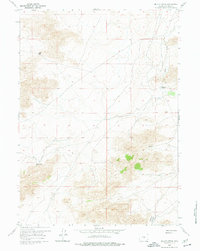
1959 Map of Miller Spring
USGS Topo · Published 1961About this map
Sweetwater Rocks dominates this high-plains landscape in central Wyoming, where the granite outcrops rise abruptly from the basin floor. The mapping captures a quiet period in Natrona County during the late 1950s, showing the intersection of ranching life and early natural resource exploration. Evidence of human activity is sparse but significant, centered on the Riddle Ranch and a lone Mine site. Water, the most critical resource in this arid terrain, is carefully documented through features like Miller Spring and the drainage of Dry Creek. The layout of unimproved roads and geographic landmarks like Wolf Gap and Ordway Pocket illustrates the navigation patterns used by locals and prospectors before the expansion of more modern infrastructure.
Find a feature on this map
9 named features on this map. Tap any name to fly to it.
Don’t see what you’re looking for? This feature index may not catch every label — zoom into the map to look around manually.
Map Details
Editions of this 1959 Miller Spring Map
2 editions found
Other maps of this area

1951 · Savage Peak
USGS Topo · 1:24,000

1951 · Bucklin Reservoirs
USGS Topo · 1:24,000

1951 · Independence Rock
USGS Topo · 1:24,000

1951 · Lone Mountain
USGS Topo · 1:24,000

1955 · Casper
USGS Topo · 1:250,000

1958 · Casper
USGS Topo · 1:250,000

1959 · Saddle Rock
USGS Topo · 1:24,000

1959 · Blackjack Ranch
USGS Topo · 1:24,000

1959 · Barlow Gap
USGS Topo · 1:24,000
1959 · Beulah Belle Lake
USGS Topo · 1:24,000