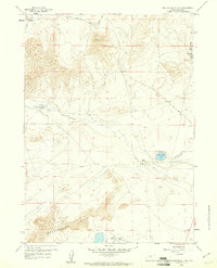
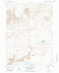
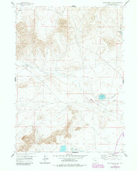
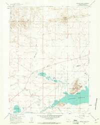
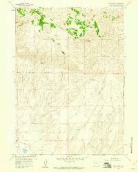
1959 Map of Beulah Belle Lake
USGS Topo · Published 1961About this map
Sweetwater Rocks anchor the southern edge of this mid-century Natrona County landscape, where the high desert terrain is defined by seasonal watercourses and remote ranching outposts. The map reveals a network of working ranch lands, including the Bug Ranch in the northwest and Oilean Ranch further east, illustrating the enduring agricultural patterns of the central Wyoming plains. Notable water features like Beulah Belle Lake and the Soda Lakes provide critical landmarks in a region largely drained by Dry Creek and Black Rock Draw.
Find a feature on this map
13 named features on this map. Tap any name to fly to it.
Don’t see what you’re looking for? This feature index may not catch every label — zoom into the map to look around manually.
Map Details
Editions of this 1959 Beulah Belle Lake Map
3 editions found
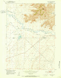
Other maps of this area
1951 · Savage Peak
USGS Topo · 1:24,000
1951 · Independence Rock
USGS Topo · 1:24,000
1951 · Fort Ridge
USGS Topo · 1:24,000

1955 · Casper
USGS Topo · 1:250,000

1958 · Casper
USGS Topo · 1:250,000
1959 · Horse Creek Springs
USGS Topo · 1:24,000
1959 · Sanford Ranch
USGS Topo · 1:24,000
1959 · Saddle Rock
USGS Topo · 1:24,000
1959 · Miller Spring
USGS Topo · 1:24,000
1959 · Barlow Gap
USGS Topo · 1:24,000