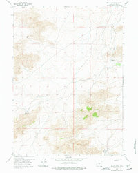
1959 Map of Miller Spring
USGS Topo · Published 1977About this map
Miller Spring and the surrounding high desert of Natrona County are captured here during a 1959 field check, revealing a landscape defined by isolated water sources and ranching outposts. The map documents the quiet transition of land use in this part of Wyoming, notably marking the Riddle Ranch (Aband) and a solitary Mine situated near the headwaters of Dry Creek. Natural landmarks like Wolf Gap and the geologic depression known as Ordway Pocket provide essential orientation in an area where human activity is sparse.
Find a feature on this map
10 named features on this map. Tap any name to fly to it.
Don’t see what you’re looking for? This feature index may not catch every label — zoom into the map to look around manually.
Map Details
Editions of this 1959 Miller Spring Map
2 editions found
Other maps of this area

1951 · Savage Peak
USGS Topo · 1:24,000

1951 · Bucklin Reservoirs
USGS Topo · 1:24,000

1951 · Independence Rock
USGS Topo · 1:24,000

1951 · Lone Mountain
USGS Topo · 1:24,000

1955 · Casper
USGS Topo · 1:250,000

1958 · Casper
USGS Topo · 1:250,000

1959 · Saddle Rock
USGS Topo · 1:24,000

1959 · Miller Spring
USGS Topo · 1:24,000

1959 · Blackjack Ranch
USGS Topo · 1:24,000

1959 · Barlow Gap
USGS Topo · 1:24,000