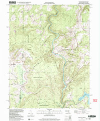
1999 Map of Sang Run
USGS Topo · Published 2000About this map
The Youghiogheny River carves a deep valley through this corner of Garrett County, where Maryland meets West Virginia. The landscape is defined by the high ridges of Negro Mountain and Snaggy Mountain, much of which is preserved within the Garrett State Forest and Swallow Falls State Park. These protected lands surround early rural infrastructure, including a Power Plant and Surge Tank near Hays Run. Small agricultural and timber settlements like Cranesville and Sang Run anchor the valley, while the edge of Deep Creek Lake appears in the southeast. Cultural markers of the late 20th century reveal a deeply rooted community, from the Sivier Cem and White Rock Ch to the local Lynn Dale Sch. The complex drainage network of Muddy Creek and numerous runs, such as Salt Block Run and Ginseng Run, illustrates the rugged topography that has historically shaped transport and land use in this Appalachian region.
Find a feature on this map
66 named features on this map. Tap any name to fly to it.
Don’t see what you’re looking for? This feature index may not catch every label — zoom into the map to look around manually.
Map Details
Editions of this 1999 Sang Run Map
2 editions found
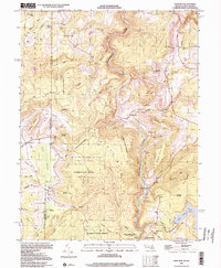
Other maps of this area

1886 · St. George
USGS Topo · 1:125,000

1891 · St. George
USGS Topo · 1:125,000

1895 · Piedmont
USGS Topo · 1:125,000

1899 · Oakland
USGS Topo · 1:62,500

1900 · Accident
USGS Topo · 1:62,500

1900 · Oakland
USGS Topo · 1:62,500

1904 · Bruceton
USGS Topo · 1:62,500

1907 · Kingwood
USGS Topo · 1:62,500

1925 · Kingwood
USGS Topo · 1:62,500

1926 · Bruceton
USGS Topo · 1:62,500