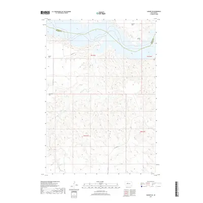
2017 Map of Sansarc NE
USGS Topo · Published 2017About this map
Lake Oahe dominates the northern reaches of this landscape, where the Missouri River valley meets the high plains of South Dakota. The boundary between Dewey and Stanley Counties cuts through the water and across the high plateaus, marking a transition in this rural ranching country. High, level benches above the drainage systems are identified as Kid Rich Flats, Marion Flats, and Mississippi Flats, providing rare stretches of flat ground amidst the deeply dissected coulees and breaks that feed into Foster Cr. Local history is preserved in small, remote sites such as Walking Horse Cem and Lindsay Cem, which stand as landmarks of early settlement and tribal heritage. Access to these areas is limited to primitive routes like Foster Bay Rd and Mule Deer Rd, reflecting the sparse population and preserved character of this riverine environment.
Find a feature on this map
15 named features on this map. Tap any name to fly to it.
Don’t see what you’re looking for? This feature index may not catch every label — zoom into the map to look around manually.
Map Details
Editions of this 2017 Sansarc NE Map
This is the sole edition of this map. No revisions or reprints were ever made.
Other maps of this area

1954 · Pierre
USGS Topo · 1:250,000

1956 · Alleman Station
USGS Topo · 1:24,000

1956 · Rousseau Creek SW
USGS Topo · 1:24,000

1956 · Herbert Creek SE
USGS Topo · 1:24,000

1956 · Sansarc NE
USGS Topo · 1:24,000

1956 · Crockett Mountains
USGS Topo · 1:24,000

1958 · Pierre
USGS Topo · 1:250,000

1981 · Herbert Creek SW
USGS Topo · 1:24,000

1982 · Sansarc
USGS Topo · 1:24,000

1982 · Whiteman Ranch
USGS Topo · 1:24,000