
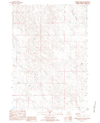
1982 Map of Sansarc
USGS Topo · Published 1983About this map
Sansarc is depicted as a sparse, ranching-dependent settlement in central South Dakota during the late 1970s and early 1980s. The landscape is defined by the winding drainages of the North Fork Sansarc Creek and Lone Tree Creek, which provided critical water sources for the numerous family ranching operations scattered across the section lines. These include the Norman Ranch, Scarborough Ranch, and Borden Ranch, representing the enduring pastoral economy of Stanley County.
Find a feature on this map
16 named features on this map. Tap any name to fly to it.
Don’t see what you’re looking for? This feature index may not catch every label — zoom into the map to look around manually.
Map Details
Editions of this 1982 Sansarc Map
This is the sole edition of this map. No revisions or reprints were ever made.
Other maps of this area

1954 · Pierre
USGS Topo · 1:250,000

1956 · Alleman Station
USGS Topo · 1:24,000

1956 · Sansarc NE
USGS Topo · 1:24,000

1956 · Crockett Mountains
USGS Topo · 1:24,000

1958 · Pierre
USGS Topo · 1:250,000

1980 · Princes Ranch
USGS Topo · 1:25,000

1982 · Whiteman Ranch
USGS Topo · 1:24,000

1983 · Bentley Ranch
USGS Topo · 1:24,000

1983 · Hayes North
USGS Topo · 1:24,000
1983 · Standing Butte SW
USGS Topo · 1:24,000