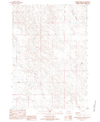
1983 Map of Standing Butte SW
USGS Topo · Published 1983About this map
Sansarc Creek carves a winding path through this Stanley County landscape, reflecting the isolated ranching life of central South Dakota in the late 1970s and early 1980s. The map highlights the sparse settlement pattern of the region, anchored by family-named operations such as Rose Ranch, Olson Ranch, and Barrick Ranch. These outposts are connected by a thin network of unimproved roads and a notable powerline corridor that traverses the drainage basins of the North Fork and West Fork Minneconjou Creek. A solitary Landing Strip at the Rose Ranch and scattered Historical Markers suggest a territory where distance is managed by air and heritage is marked along the road. The terrain is defined by the complex interlocking ridges and draws of the Missouri Plateau, captured here just as modern digital photogrammetric methods were being integrated into USGS provisional mapping.
Find a feature on this map
12 named features on this map. Tap any name to fly to it.
Don’t see what you’re looking for? This feature index may not catch every label — zoom into the map to look around manually.
Map Details
Editions of this 1983 Standing Butte SW Map
This is the sole edition of this map. No revisions or reprints were ever made.
Other maps of this area

1954 · Pierre
USGS Topo · 1:250,000

1956 · Sansarc NE
USGS Topo · 1:24,000

1956 · Crockett Mountains
USGS Topo · 1:24,000

1958 · Pierre
USGS Topo · 1:250,000

1980 · Princes Ranch
USGS Topo · 1:25,000

1982 · Sansarc
USGS Topo · 1:24,000

1982 · Mission Ridge
USGS Topo · 1:24,000

1983 · Hayes North
USGS Topo · 1:24,000

1983 · Standing Butte
USGS Topo · 1:24,000

1983 · Philip
USGS Topo · 1:100,000