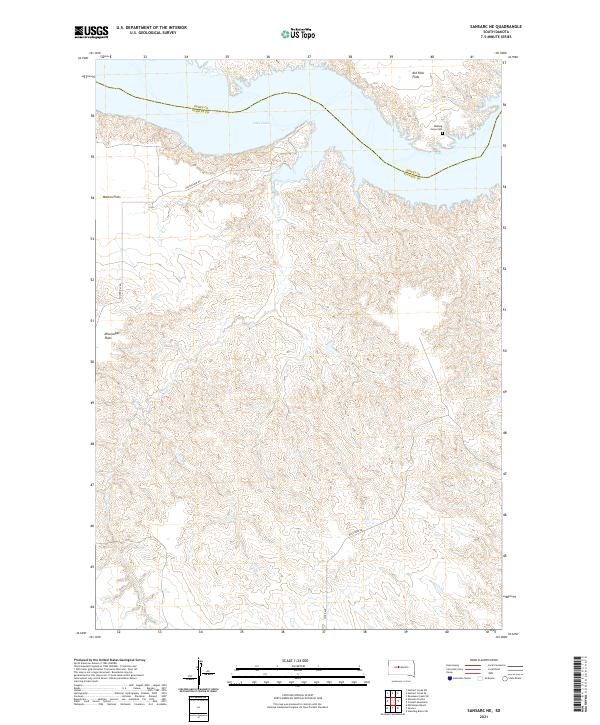
2021 Map of Sansarc NE
USGS Topo · Published 2021About this map
Lake Oahe dominates the northern landscape of this South Dakota quadrangle, where the waters of the Missouri River reservoir meet the expansive benchlands of Kid Rich Flats and Marion Flats. The geography is defined by the high plateaus and deep drainages that feed into the lake, most notably the winding course of Foster Cr. The map captures a section of the Dewey County and Stanley County line, highlighting a sparsely populated ranching and grazing region where landform names like Mississippi Flats provide the primary points of reference.
Find a feature on this map
15 named features on this map. Tap any name to fly to it.
Don’t see what you’re looking for? This feature index may not catch every label — zoom into the map to look around manually.
Map Details
Editions of this 2021 Sansarc NE Map
This is the sole edition of this map. No revisions or reprints were ever made.
Other maps of this area

1954 · Pierre
USGS Topo · 1:250,000

1956 · Alleman Station
USGS Topo · 1:24,000

1956 · Rousseau Creek SW
USGS Topo · 1:24,000

1956 · Herbert Creek SE
USGS Topo · 1:24,000

1956 · Sansarc NE
USGS Topo · 1:24,000

1956 · Crockett Mountains
USGS Topo · 1:24,000

1958 · Pierre
USGS Topo · 1:250,000

1981 · Herbert Creek SW
USGS Topo · 1:24,000

1982 · Sansarc
USGS Topo · 1:24,000

1982 · Whiteman Ranch
USGS Topo · 1:24,000