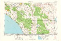
1960 Map of Santa Ana
USGS Topo · Published 1960About this map
Santa Ana and the rapidly expanding urban corridor of Orange County serve as the western anchor for this mid-century survey. The landscape transitions from the coastal communities of Newport Beach and Laguna Beach into the formidable Santa Ana Mountains and San Jacinto Mountains. Transportation networks are heavily defined by the Santa Ana Freeway and major rail lines like the Atchison Topeka and Santa Fe RR, which connect the coastal plains to the inland valleys.
Find a feature on this map
192 named features on this map. Tap any name to fly to it.
Don’t see what you’re looking for? This feature index may not catch every label — zoom into the map to look around manually.
Map Details
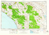
Editions of this 1960 Santa Ana Map
2 editions found
Other maps of this area

1893 · El Cajon
USGS Topo · 1:62,500

1893 · Oceanside
USGS Topo · 1:62,500

1893 · Escondido
USGS Topo · 1:62,500

1894 · Los Angeles
USGS Topo · 1:62,500

1894 · Pomona
USGS Topo · 1:62,500

1896 · Santa Ana
USGS Topo · 1:62,500

1896 · Pasadena
USGS Topo · 1:62,500

1896 · Anaheim
USGS Topo · 1:62,500

1896 · San Bernardino
USGS Topo · 1:62,500

1896 · Las Bolsas
USGS Topo · 1:62,500