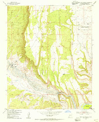
1954 Map of Santa Ana Pueblo
USGS Topo · Published 1955About this map
Santa Ana Pueblo sits at the western edge of this 1954 landscape, defined by the convergence of the Jemez River and the Rio Grande. This mid-century survey illustrates significant hydraulic engineering on the high desert, specifically the Jemez Canyon Dam Spillway 5232 and its associated Stilling Basin and Overflow. The terrain is a complex arrangement of colonial-era land divisions, including the Santa Ana Grant and the Angostura Grant, which neighbor the San Felipe Indian Reservation. Infrastructure from earlier eras remains visible through the Old Railroad Grade traversing the river valley. Evidence of local industry is sparse but present, marked by a Gravel Pit near the river and an inactive Strip Mine on the northern Mesa, reflecting the area's shift toward water management and controlled irrigation via the river Levee system.
Find a feature on this map
20 named features on this map. Tap any name to fly to it.
Don’t see what you’re looking for? This feature index may not catch every label — zoom into the map to look around manually.
Map Details
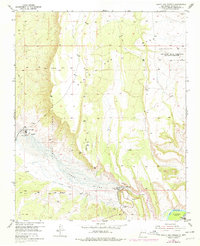
Editions of this 1954 Santa Ana Pueblo Map
2 editions found
Other maps of this area

1888 · Bernalillo
USGS Topo · 1:125,000

1889 · Albuquerque
USGS Topo · 1:125,000

1890 · Jemes
USGS Topo · 1:125,000

1892 · San Pedro
USGS Topo · 1:125,000

1892 · Jemes
USGS Topo · 1:125,000

1892 · Santa Clara
USGS Topo · 1:125,000

1893 · Albuquerque
USGS Topo · 1:125,000

1943 · Jemez
USGS Topo · 1:62,500

1952 · Jemez
USGS Topo · 1:62,500

1953 · Santo Domingo Pueblo SW
USGS Topo · 1:24,000