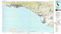
1982 Map of Santa Barbara
USGS Topo · Published 1992About this map
Santa Barbara and the coastal corridor of the early 1980s are defined by the narrow margin of habitable land between the Santa Ynez Mountains and the Santa Barbara Channel. This survey provides a meticulous view of the regional infrastructure before late-century expansion, detailing the path of the Southern Pacific Railroad and US Highway 101 as they connect coastal hubs like Ventura, Carpinteria, and Oxnard. The map captures a high concentration of institutional and military installations, including the University of California Santa Barbara, the Point Mugu Naval Air Station, and the Camarillo State Hospital.
Find a feature on this map
180 named features on this map. Tap any name to fly to it.
Don’t see what you’re looking for? This feature index may not catch every label — zoom into the map to look around manually.
Map Details
Editions of this 1982 Santa Barbara Map
3 editions found
Other maps of this area

1900 · Triunfo Pass
USGS Topo · 1:62,500

1900 · Piru
USGS Topo · 1:62,500

1902 · Santa Ynez
USGS Topo · 1:125,000

1903 · Santa Paula
USGS Topo · 1:62,500

1903 · Mt. Pinos
USGS Topo · 1:125,000

1903 · Tejon
USGS Topo · 1:125,000

1903 · Camulos
USGS Topo · 1:125,000

1904 · Ventura
USGS Topo · 1:62,500

1904 · Hueneme
USGS Topo · 1:62,500

1905 · Santa Ynez
USGS Topo · 1:125,000