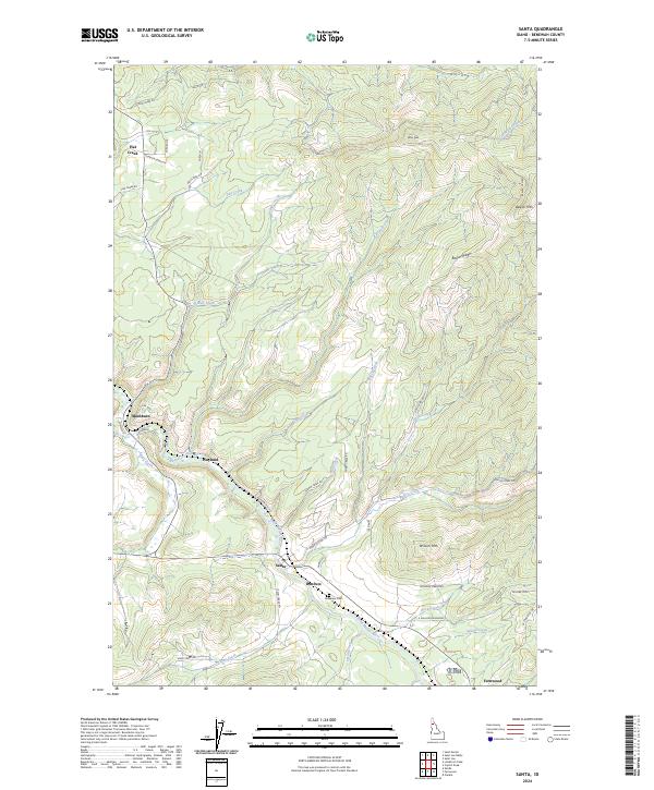
2024 Map of Santa
USGS Topo · Published 2024About this map
The Saint Maries River valley serves as the central artery for this part of Benewah County, Idaho, where several small settlements are connected by a network of drainage-following roads. The town of Santa and the neighboring hamlet of Renfrew sit at the junction of the river and Santa Creek, while Fernwood occupies the southeastern reach near the Elkhorn Meadows. The rugged topography is defined by high points like Pettis Peak and Wilson Mtn, with many smaller communities such as Mashburn and Wayland established along the lower elevations of Beaver Creek and the river. Genealogists can identify the local Riverview Cem located between Santa and Fernwood. The landscape shows a clear pattern of land use where forestry and mountain access roads, including Tramm Creek Rd and Pokey Creek Rd, pierce the dense mountain ridges of Beaver Ridge.
Find a feature on this map
53 named features on this map. Tap any name to fly to it.
Don’t see what you’re looking for? This feature index may not catch every label — zoom into the map to look around manually.
Map Details
Editions of this 2024 Santa Map
This is the sole edition of this map. No revisions or reprints were ever made.
Other maps of this area

1955 · Spokane
USGS Topo · 1:250,000

1957 · St. Maries
USGS Topo · 1:62,500

1957 · Emida
USGS Topo · 1:62,500

1957 · St. Joe
USGS Topo · 1:62,500

1958 · Spokane
USGS Topo · 1:250,000

1961 · Fernwood
USGS Topo · 1:62,500

1981 · St Maries
USGS Topo · 1:100,000
1981 · St Maries
USGS Topo · 1:24,000
1985 · St. Joe Baldy
USGS Topo · 1:24,000
1985 · St. Joe
USGS Topo · 1:24,000