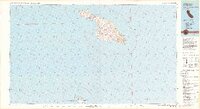
1981 Map of Santa Catalina Island
USGS Topo · Published 1981About this map
Santa Catalina Island and the northern tip of San Clemente Island dominate this 1981 maritime and topographic study, which highlights the rugged interior and essential harbors of the Channel Islands. The map documents the primary settlement at Avalon and the narrower isthmus at Two Harbors, where Isthmus Cove and Catalina Harbor nearly meet. Inland, the terrain rises to notable peaks such as Mt Orizaba and Black Jack Mtn, while the southern island features the high-security Naval Ocean Systems Center San Clemente Island Facility.
Find a feature on this map
50 named features on this map. Tap any name to fly to it.
Don’t see what you’re looking for? This feature index may not catch every label — zoom into the map to look around manually.
Map Details
Editions of this 1981 Santa Catalina Island Map
2 editions found
Other maps of this area

1896 · Santa Ana
USGS Topo · 1:62,500

1896 · Las Bolsas
USGS Topo · 1:62,500

1896 · San Pedro
USGS Topo · 1:62,500

1901 · Southern California Sheet No. 1
USGS Topo · 1:250,000

1901 · Santa Ana
USGS Topo · 1:62,500

1902 · Capistrano
USGS Topo · 1:125,000

1902 · Corona
USGS Topo · 1:125,000

1904 · Southern California Sheet No. 1
USGS Topo · 1:250,000

1906 · Capistrano
USGS Topo · 1:125,000
1941 · Las Bolsas
USGS Topo · 1:62,500