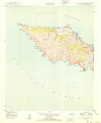
1950 Map of Santa Catalina West
USGS Topo · Published 1950About this map
Silver Peak dominates the high, ridged interior of the western end of Santa Catalina Island, where steep canyons descend to a perimeter of numerous named coves and rocky points. This mid-century survey shows the area's development concentrated at remote outposts like Parsons Landing and Johnsons Landing, and the specialized establishment of the Girl Scouts Camp at Emerald Bay. The westernmost tip of the island is marked by the Catalina Island West End Light at Lands End, a critical navigational aid for vessels navigating the San Pedro Channel. To the south, the deep indentation of Catalina Harbor is protected by Catalina Head and Ballast Point, offering a glimpse into the maritime refuge used by sailors long before modern development reached these shores.
Find a feature on this map
37 named features on this map. Tap any name to fly to it.
Don’t see what you’re looking for? This feature index may not catch every label — zoom into the map to look around manually.
Map Details
Editions of this 1950 Santa Catalina West Map
This is the sole edition of this map. No revisions or reprints were ever made.
Other maps of this area

1896 · San Pedro
USGS Topo · 1:62,500

1901 · Southern California Sheet No. 1
USGS Topo · 1:250,000

1904 · Southern California Sheet No. 1
USGS Topo · 1:250,000

1943 · San Pedro
USGS Topo · 1:125,000

1943 · Santa Catalina North
USGS Topo · 1:24,000

1943 · Santa Catalina South
USGS Topo · 1:24,000
1943 · Santa Catalina West
USGS Topo · 1:24,000
1944 · San Pedro
USGS Topo · 1:62,500

1949 · Long Beach
USGS Topo · 1:250,000
1950 · Santa Catalina South
USGS Topo · 1:24,000