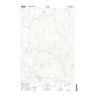
2016 Map of Santa Clara
USGS Topo · Published 2016About this map
Santa Clara and Reynoldston anchor this modern survey of the northern Adirondack wilderness, where the landscape is defined by the winding paths of the Saint Regis River and the Deer River. The terrain is characterized by a dense network of water bodies and prominent summits, including the notable peaks of Conger Mtn and The Pinnacle. The southern portion of the sheet transitions into the protected lands of the Adirondack Park Preserve, highlighting the region's long-standing balance between small settlements and large-scale conservation. A complex system of historical roads, such as Red Tavern Rd and Reynoldston Rd, traces the routes once used for local timber and travel. For the researcher, the map preserves the exact names of numerous brooks and ponds, from Little Cold Brook to Black Pond, that have shaped the local geography for generations.
Find a feature on this map
55 named features on this map. Tap any name to fly to it.
Don’t see what you’re looking for? This feature index may not catch every label — zoom into the map to look around manually.
Map Details
Editions of this 2016 Santa Clara Map
This is the sole edition of this map. No revisions or reprints were ever made.
Other maps of this area

1915 · Malone
USGS Topo · 1:62,500

1915 · Moira
USGS Topo · 1:62,500

1917 · Malone
USGS Topo · 1:62,500

1917 · Moira
USGS Topo · 1:62,500

1919 · Nicholville
USGS Topo · 1:62,500

1921 · Nicholville
USGS Topo · 1:62,500

1921 · Santa Clara
USGS Topo · 1:62,500

1923 · Santa Clara
USGS Topo · 1:62,500

1944 · Moira
USGS Topo · 1:62,500

1948 · Ogdensburg
USGS Topo · 1:250,000