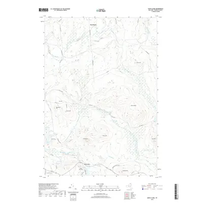
2019 Map of Santa Clara
USGS Topo · Published 2019About this map
Santa Clara sits at the southern reach of this Franklin County landscape, where the Saint Regis River and the East Branch Saint Regis River converge amidst a dense network of ponds and wetlands. This modern survey reflects the enduring character of the North Country, defined by the extensive Adirondack Park Preserve and a topography of prominent rises like Mutton Ridge and Conger Mtn. The settlement of Reynoldston anchors the northern border along the Deer River, connected by historically significant routes such as Red Tavern Rd.
Find a feature on this map
54 named features on this map. Tap any name to fly to it.
Don’t see what you’re looking for? This feature index may not catch every label — zoom into the map to look around manually.
Map Details
Editions of this 2019 Santa Clara Map
This is the sole edition of this map. No revisions or reprints were ever made.
Other maps of this area

1915 · Malone
USGS Topo · 1:62,500

1915 · Moira
USGS Topo · 1:62,500

1917 · Malone
USGS Topo · 1:62,500

1917 · Moira
USGS Topo · 1:62,500

1919 · Nicholville
USGS Topo · 1:62,500

1921 · Nicholville
USGS Topo · 1:62,500

1921 · Santa Clara
USGS Topo · 1:62,500

1923 · Santa Clara
USGS Topo · 1:62,500

1944 · Moira
USGS Topo · 1:62,500

1948 · Ogdensburg
USGS Topo · 1:250,000