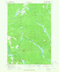
1964 Map of Santa Clara
USGS Topo · Published 1966About this map
Adirondack State Park and the expansive Franklin State Forest dominate this mid-century portrait of Franklin County. The landscape is defined by the winding course of the Deer River in the north and the St Regis River to the south, where the small settlement of Santa Clara sits at the foot of Little Hurd Hill. This era shows a region shaped by state conservation efforts, with the Waverly State Forest Preserve and various tracts of the Forest Preserve covering the majority of the terrain.
Find a feature on this map
44 named features on this map. Tap any name to fly to it.
Don’t see what you’re looking for? This feature index may not catch every label — zoom into the map to look around manually.
Map Details
Editions of this 1964 Santa Clara Map
2 editions found
Other maps of this area

1915 · Malone
USGS Topo · 1:62,500

1915 · Moira
USGS Topo · 1:62,500

1917 · Malone
USGS Topo · 1:62,500

1917 · Moira
USGS Topo · 1:62,500

1919 · Nicholville
USGS Topo · 1:62,500

1921 · Nicholville
USGS Topo · 1:62,500

1921 · Santa Clara
USGS Topo · 1:62,500

1923 · Santa Clara
USGS Topo · 1:62,500

1944 · Moira
USGS Topo · 1:62,500

1948 · Ogdensburg
USGS Topo · 1:250,000