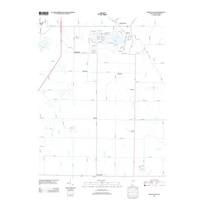
2013 Map of Santa Claus
USGS Topo · Published 2013About this map
Santa Claus and its holiday-themed geography define this part of Spencer County, where street names like E Sleigh Bell Dr, W Dancer Ln, and S Snow Ball Ln surround the shores of Christmas Lake. This unique residential layout contrasts with the traditional rural grid found in nearby Santa Fe and the agricultural lands surrounding the Foertsch Airport. To the west, the landscape transitions toward Lincoln City and the waters of Lake Lincoln, while smaller communities such as Buffaloville, Clay City, and Liberal are linked by a network of county roads. The drainage of the region is managed by features like the Davis Enlow Ditch and the winding course of Crooked Cr, which flows toward Lamar. In the southern reaches, the map records Newtonville and the secluded Cedar Crest Lake, illustrating the varied settlement patterns of southern Indiana in the early 21st century.
Find a feature on this map
93 named features on this map. Tap any name to fly to it.
Don’t see what you’re looking for? This feature index may not catch every label — zoom into the map to look around manually.
Map Details
Editions of this 2013 Santa Claus Map
This is the sole edition of this map. No revisions or reprints were ever made.
Other maps of this area

1900 · St Meinrad
USGS Topo · 1:62,500

1900 · De Gonia Springs
USGS Topo · 1:62,500

1901 · Owensboro
USGS Topo · 1:62,500

1902 · Ditney
USGS Topo · 1:125,000

1902 · Degonia Springs
USGS Topo · 1:62,500

1903 · St. Meinrad
USGS Topo · 1:62,500

1903 · Tell City
USGS Topo · 1:62,500

1952 · Rockport
USGS Topo · 1:24,000

1953 · Lewisport
USGS Topo · 1:24,000

1953 · Tell City
USGS Topo · 1:24,000