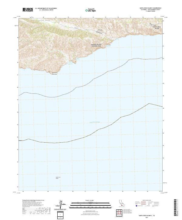
2021 Map of Santa Cruz Island C
USGS Topo · Published 2021About this map
Santa Cruz Island and the surrounding waters of the Pacific Ocean are documented in this 2021 topographic record. The map highlights the protected coastal landscape of Channel Islands National Park, focusing on the island's southern shoreline and interior depressions. The notable Central Valley runs across the northern portion of the sheet, providing a geographic corridor that stands in contrast to the high ridges of the interior.
Find a feature on this map
12 named features on this map. Tap any name to fly to it.
Don’t see what you’re looking for? This feature index may not catch every label — zoom into the map to look around manually.
Map Details
Editions of this 2021 Santa Cruz Island C Map
This is the sole edition of this map. No revisions or reprints were ever made.
Other maps of this area
1943 · Santa Cruz Island B
USGS Topo · 1:24,000
1943 · Santa Cruz Island C
USGS Topo · 1:24,000

1949 · Los Angeles
USGS Topo · 1:250,000

1949 · Long Beach
USGS Topo · 1:250,000

1955 · Los Angeles
USGS Topo · 1:250,000

1957 · Long Beach
USGS Topo · 1:250,000

1958 · Long Beach
USGS Topo · 1:250,000

1959 · Los Angeles
USGS Topo · 1:250,000

1960 · Long Beach
USGS Topo · 1:250,000

1966 · Los Angeles
USGS Topo · 1:250,000