
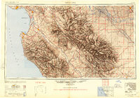
1948 Map of Santa Cruz
USGS Topo · Published 1948About this map
Monterey Bay serves as the focal point for this post-war landscape, where the agricultural corridors of the Salinas River and San Benito River meet the Pacific. The presence of significant military installations like the Fort Ord Military Reservation and Monterey NAAS reflects the strategic coastal importance of the era. Along the historic route of El Camino Real, established settlements such as Watsonville, Salinas, and the mission town of San Juan Bautista anchor the regional economy.
Find a feature on this map
106 named features on this map. Tap any name to fly to it.
Don’t see what you’re looking for? This feature index may not catch every label — zoom into the map to look around manually.
Map Details
Editions of this 1948 Santa Cruz Map
2 editions found
Other maps of this area

1902 · Santa Cruz
USGS Topo · 1:125,000

1910 · Gonzales
USGS Topo · 1:31,680

1910 · Salinas
USGS Topo · 1:31,680

1910 · Soledad
USGS Topo · 1:31,680

1912 · Salinas
USGS Topo · 1:62,500

1912 · Coalinga
USGS Topo · 1:125,000

1912 · San Ardo
USGS Topo · 1:31,680

1912 · Metz
USGS Topo · 1:31,680

1912 · Mariposa
USGS Topo · 1:125,000

1912 · Capitola
USGS Topo · 1:62,500