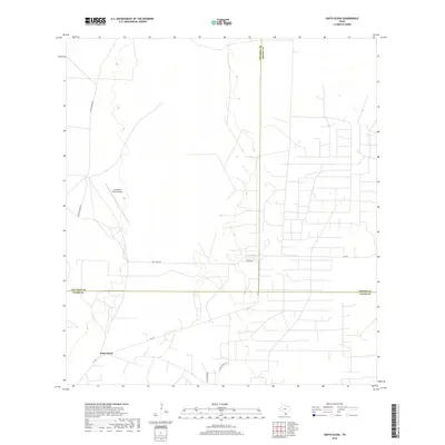
2019 Map of Santa Elena
USGS Topo · Published 2019About this map
Santa Elena serves as a central point in this South Texas landscape where the borders of Starr, Jim Hogg, and Brooks Counties converge. The region is defined by a sparse network of ranch roads and thoroughfares, including Fm 755 and Kelsy Bass Rd, which navigate the brush country and sand plains. Transportation in this corner of the Rio Grande Valley is further supported by the San Rafael Ranch Airport, a private landing strip indicative of the large-scale ranching operations that characterize the local economy. Historical transit and local heritage are evidenced by named routes such as Old Church Rd and Old San Isidro Rd, which point to established paths between rural settlements and religious centers in this predominantly agricultural environment.
Find a feature on this map
11 named features on this map. Tap any name to fly to it.
Don’t see what you’re looking for? This feature index may not catch every label — zoom into the map to look around manually.
Map Details
Editions of this 2019 Santa Elena Map
This is the sole edition of this map. No revisions or reprints were ever made.
Other maps of this area

1938 · Agua Nueva
USGS Topo · 1:62,500

1938 · Sal Colorada
USGS Topo · 1:62,500

1939 · La Reforma
USGS Topo · 1:62,500

1939 · Encantada
USGS Topo · 1:62,500

1949 · Mc Allen
USGS Topo · 1:250,000

1954 · McAllen
USGS Topo · 1:250,000

1957 · Mc Allen
USGS Topo · 1:250,000

1962 · McAllen
USGS Topo · 1:250,000
1972 · Santa Elena SE
USGS Topo · 1:24,000
1972 · Tacubaya
USGS Topo · 1:24,000