
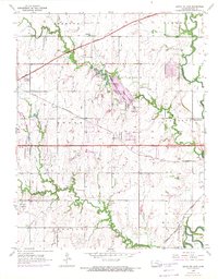
1955 Map of Santa Fe Lake
USGS Topo · Published 1956About this map
Butler County State Park and the adjacent Santa Fe Lake serve as the centerpiece of this mid-1950s survey of Butler County. The landscape is characterized by the meandering Whitewater River and Walnut River, which define the eastern portion of the quadrangle. The era's infrastructure is prominently displayed, featuring the construction of the Kansas Turnpike cutting diagonally across the prairie, alongside established rail lines like the St Louis San Francisco and the Atchison Topeka and Santa Fe. Local community life is documented through scattered rural landmarks, including the Indianola Sch and Lily Lake Sch, and small family burial grounds like Indianola Cem. Pockets of petroleum extraction are evident through several Oil Well and Oil Tank clusters, particularly near the southern and eastern river bottoms, reflecting the region's energy economy during this period.
Find a feature on this map
29 named features on this map. Tap any name to fly to it.
Don’t see what you’re looking for? This feature index may not catch every label — zoom into the map to look around manually.
Map Details
Editions of this 1955 Santa Fe Lake Map
3 editions found
Other maps of this area

1888 · Eldorado
USGS Topo · 1:125,000

1889 · Wichita
USGS Topo · 1:125,000

1894 · Wichita
USGS Topo · 1:125,000

1945 · Andover
USGS Topo · 1:31,680

1955 · Benton
USGS Topo · 1:24,000

1955 · Greenwich
USGS Topo · 1:24,000

1955 · Rose Hill
USGS Topo · 1:24,000

1955 · Douglass
USGS Topo · 1:24,000

1955 · Wichita
USGS Topo · 1:250,000
1956 · Andover
USGS Topo · 1:24,000