
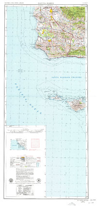
1956 Map of Santa Maria
USGS Topo · Published 1973About this map
The coastal shelf of the Santa Maria Valley and the northern Channel Islands are documented in this mid-century topographic perspective. Heavily dominated by military and agricultural development, the landscape features the expanding Vandenberg AFB and the Lompoc District Disciplinary Barracks alongside the industrial presence of an oil field near Orcutt. The Southern Pacific railroad hugs the shoreline, passing through small coastal stations like Surf and Casmalia while connecting the inland hubs of Lompoc and Santa Maria.
Find a feature on this map
70 named features on this map. Tap any name to fly to it.
Don’t see what you’re looking for? This feature index may not catch every label — zoom into the map to look around manually.
Map Details
Editions of this 1956 Santa Maria Map
2 editions found
Other maps of this area

1897 · Port Harford
USGS Topo · 1:62,500

1897 · Arroyo Grande
USGS Topo · 1:62,500

1900 · San Luis
USGS Topo · 1:125,000

1902 · Santa Ynez
USGS Topo · 1:125,000

1905 · Guadalupe
USGS Topo · 1:125,000

1905 · Santa Ynez
USGS Topo · 1:125,000

1905 · Lompoc
USGS Topo · 1:125,000

1912 · McKittrick
USGS Topo · 1:125,000

1922 · Nipomo
USGS Topo · 1:62,500

1937 · Branch Mtn
USGS Topo · 1:48,000