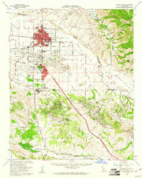
1959 Map of Santa Maria
USGS Topo · Published 1961About this map
Santa Maria sits at the heart of an intensive agricultural and petroleum landscape in the late 1950s, bounded by the Nipomo Mesa and the San Rafael Mountains. The city's residential growth is evident through a network of local institutions like Robert Bruce Sch and Nightingale Sch, while the industrial backbone is defined by the Santa Maria Valley RR and the Oil Refinery at Midco.
Find a feature on this map
68 named features on this map. Tap any name to fly to it.
Don’t see what you’re looking for? This feature index may not catch every label — zoom into the map to look around manually.
Map Details
Editions of this 1959 Santa Maria Map
2 editions found
Other maps of this area

1897 · Arroyo Grande
USGS Topo · 1:62,500

1900 · San Luis
USGS Topo · 1:125,000

1905 · Guadalupe
USGS Topo · 1:125,000

1905 · Lompoc
USGS Topo · 1:125,000

1922 · Nipomo
USGS Topo · 1:62,500

1937 · Branch Mtn
USGS Topo · 1:48,000

1942 · Point Arguello
USGS Topo · 1:62,500

1942 · Guadalupe
USGS Topo · 1:125,000

1942 · Lompoc
USGS Topo · 1:125,000

1942 · Lompoc
USGS Topo · 1:62,500