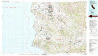
1982 Map of Santa Maria
USGS Topo · Published 1983About this map
Vandenberg Air Force Base occupies a massive stretch of the coastline, shaping the geography of this part of Santa Barbara County. The map details the transition from the specialized military and aerospace installations on the Burton Mesa to the agricultural and urban centers of Santa Maria and Lompoc. Historic land use is evident in the sprawling ranch lands and the presence of the La Purisima Mission State Historical Mon, which anchors the valley's colonial history near the Santa Ynez River.
Find a feature on this map
66 named features on this map. Tap any name to fly to it.
Don’t see what you’re looking for? This feature index may not catch every label — zoom into the map to look around manually.
Map Details
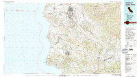
Editions of this 1982 Santa Maria Map
2 editions found
Other maps of this area

1897 · Port Harford
USGS Topo · 1:62,500

1897 · Arroyo Grande
USGS Topo · 1:62,500

1900 · San Luis
USGS Topo · 1:125,000

1902 · Santa Ynez
USGS Topo · 1:125,000

1905 · Guadalupe
USGS Topo · 1:125,000

1905 · Santa Ynez
USGS Topo · 1:125,000

1905 · Lompoc
USGS Topo · 1:125,000

1912 · McKittrick
USGS Topo · 1:125,000

1922 · Nipomo
USGS Topo · 1:62,500

1937 · Branch Mtn
USGS Topo · 1:48,000