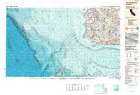
1989 Map of Santa Maria
USGS Topo · Published 1991About this map
Vandenberg Air Force Base dominates the coastline of this Central Coast survey, illustrating the significant military presence that shaped the region's late 20th-century development. Inland, the map captures the transition from the fertile agriculture of the Santa Maria River valley to the steep elevations of the San Rafael Mountains and the Sierra Madre Mountains. Historical depth is visible through the La Purisima Mission State Historical Monument near Lompoc, while the industrial landscape is represented by the Southern Pacific railroad corridor and smaller settlements like Betteravia. The map's bathymetric data reveals the submarine landscape beyond the Santa Lucia Escarpment, showing the relationship between the coastal shelf and the deep Santa Barbara Basin. Offshore, the northern Channel Islands National Park including San Miguel Island and Santa Rosa Island are detailed with terrestrial landmarks such as Cuyler Harbor and East Point.
Find a feature on this map
64 named features on this map. Tap any name to fly to it.
Don’t see what you’re looking for? This feature index may not catch every label — zoom into the map to look around manually.
Map Details
Editions of this 1989 Santa Maria Map
This is the sole edition of this map. No revisions or reprints were ever made.
Other maps of this area

1897 · Port Harford
USGS Topo · 1:62,500

1897 · Arroyo Grande
USGS Topo · 1:62,500

1900 · San Luis
USGS Topo · 1:125,000

1902 · Santa Ynez
USGS Topo · 1:125,000

1905 · Guadalupe
USGS Topo · 1:125,000

1905 · Santa Ynez
USGS Topo · 1:125,000

1905 · Lompoc
USGS Topo · 1:125,000

1912 · McKittrick
USGS Topo · 1:125,000

1922 · Nipomo
USGS Topo · 1:62,500

1937 · Branch Mtn
USGS Topo · 1:48,000